20100612134700.png
From the dataset abstract
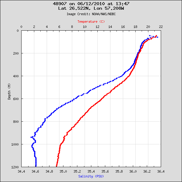
Plots temperature and salinity as a function of depth at Station 48907 - (COOK) as PNG files. Measurements were taken by the Slocum Glider, an autonomous underwater vehicle, about every...
Source: National Data Buoy Center - Station 48907 Historical Data
Additional Information
| Field | Value |
|---|---|
| Last updated | June 22, 2018 |
| Created | June 22, 2018 |
| Format | PNG |
| License | Creative Commons Attribution |
| created | over 5 years ago |
| format | PNG |
| has views | True |
| id | 96063042-d07d-4927-ba60-8e9c38d55c2e |
| on same domain | True |
| package id | 7585d7cc-c4b4-49f8-b38b-03201ada4d2e |
| position | 134 |
| revision id | 6393b1ed-5e5c-4f1e-ac51-c80c5835fd0a |
| state | active |
| url type | upload |